|
While there are at least two first-class photographers operating in Dumfries & Galloway, I don't think there's anyone with a better collection of pictures of the hill ground. The Galloway Hills (sometimes called the Galloway Highlands) are a ring of 2000ft tops including the Merrick and the Rhinns of the Kells, surrounding an area of granite slabs lochs and bog with Craignaw, the Dungeon, Mullwarchar and Loch Enoch. This is the finest, but not the only, hill ground of the region. To the south lies Cairnsmore of Fleet, and eastwards are the grassy and somewhat unexciting Carsphairn Hills with their windfarms. Eastwards again, in Dumfriesshire, are the Lowthers and the coastal granite lump of Criffel. A corner of the Moffat Hills, including Hart Fell, also lies within our region. A
MAP
is on my webpage dedicated to Walking the Lowther Hills, my very old guidebook to the area.
|
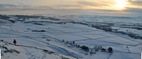
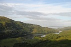
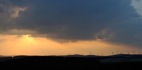
Nithsdale from Auchenleck Hill
|
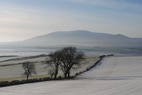
Criffel from Wardlaw
|
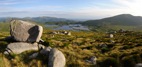
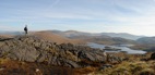
Loch Enoch and Merrick from Mullwarchar
|
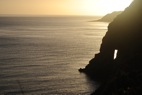
Needle's Eye, Sandyhills
|
'Look North' (Andy Goldsworthy)
|
descending Laght Hill to Comb Head
|
Thornhill Cross
|
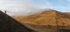
Buchan Hill, to Merrick
|
Loch Trool from Gairland Burn path
|
Turn Hill, Glenbo Hass from east ridge of Black Hill
|
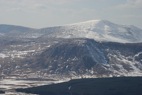
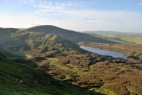
Round Loch, Dungeon Hill, Merrick, from Millfire
|
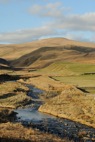
Queensberry from Capel Water
|
Clyde Windfarm from Annanhead Hill
|
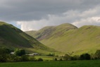
Saddle Yoke and Moffatdale
|
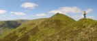
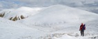
on Saddle Yoke
|
Loch Skeen from White Coomb
|
|
Redstone Rig, to Rhinns of Kells, Loch Enoch
|
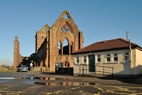
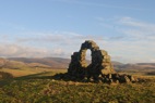
Sweetheart Abbey
|
|